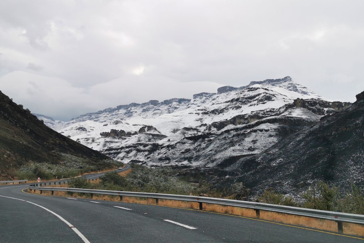
Long Tom Pass Drive
The historic pass road between Sabie and Lydenburg — mist, forest, and the longest sight-line of the Mpumalanga escarpment.
Trip Role
Ideal stay
Best for
Our take
This is a serious, high-altitude mountain pass that demands respect for its weather and heavy traffic. It is a functional, scenic transit route rather than a leisurely joyride, rewarding those who drive with focus and patience.
This is a serious, high-altitude mountain pass that demands respect for its weather and heavy traffic. It is a functional, scenic transit route rather than a leisurely joyride, rewarding those who drive with focus and patience.
- Trip Role
- Worth a Detour
- Ideal Stay
- 60 to 90 minutes, excluding stops.
- Best For
- mountain views, historic Boer War sites, high-altitude driving, forest scenery
- Skip If
- nervous drivers, those seeking a quiet, empty road
- Go If
- You are driving between Lydenburg and Sabie and want to experience the scale of the Drakensberg escarpment. It suits travellers who prefer mountain driving over flat highways and appreciate historic, high-altitude landscapes.
Why it's worth your time
An escarpment mist-road between Sabie and Lydenburg — the Long Tom pass and its Boer-war gun.
What we love
The sheer scale of the escarpment views is unmatched. Unlike the lower-lying routes, this pass climbs to over 2,100 metres, offering a perspective of the Sabie valley that makes the surrounding pine and eucalyptus forests look like a vast, green carpet stretching toward the horizon.
What to know
The weather is the primary variable. Thick mountain mist can descend without warning, reducing visibility to a few metres. Always check local conditions before departing. The road is a major commercial artery, so expect to be stuck behind heavy trucks on steep sections. Overtaking is dangerous due to blind corners and continuous barrier lines.
The full guide
The Route and Direction
The pass connects Lydenburg and Sabie via the R37. Driving from the Lydenburg side toward Sabie is generally preferred. This direction places the best viewpoints on your left, allowing for easier access to pull-offs and providing a more panoramic perspective as you descend toward the valley. The route is part of a larger network of passes, and you will likely find yourself navigating the continuous flow of the Masjiennek and Koffiehoogte sections as well. Do not expect a quick transit. While the drive itself takes about an hour without stops, the road is designed for steady, cautious movement. Plan your trip to include time for the various monuments and viewpoints, but remember that these are often located on the edge of steep drops, so pull over only where it is clearly marked and safe to do so.
The Road Surface and Hazards
The road is tarred and generally well-engineered, but it is not a modern highway. You will encounter 66 bends, some of which are tight and require careful speed management. The gradient is manageable for most vehicles, but the presence of heavy mining and logging trucks means you will frequently face slow-moving traffic. The road edges can be steep, and the drop-offs are significant. In winter, be aware of the possibility of black ice on shaded sections, particularly in the early morning. Potholes and cracks appear periodically, so keep your eyes on the tarmac rather than just the scenery. Because the road is a vital commercial link, the traffic is constant and often impatient. Never attempt to overtake on blind rises or around the many sharp corners, as the risk of oncoming heavy vehicles is high.
Weather and Visibility
The escarpment is notorious for sudden, dense mist that can turn a clear drive into a white-out in minutes. This is not a minor inconvenience; it is a genuine hazard that makes the road dangerous for those unfamiliar with the terrain. If the mist is thick, pull over at a safe, designated spot and wait for it to lift. Do not attempt to push through, as the combination of low visibility and heavy trucks is a recipe for disaster. Summer brings the added risk of thunderstorms, which can leave the road surface slick and prone to debris or sudden washouts. Always check the weather forecast for both Lydenburg and Sabie before you leave. If the forecast predicts heavy rain or fog, consider delaying your trip, as the experience is significantly diminished when you cannot see the valley below.
Before you book
Questions Long Tom Pass Drive always raises
- Is the Long Tom Pass safe for a standard sedan?
- Yes, the road is fully tarred and suitable for any standard vehicle. You do not need a 4x4 or high-clearance vehicle to drive it. The main challenges are the steep gradients, sharp corners, and the presence of heavy trucks, not the road surface itself.
- Can I drive the pass in the rain?
- You can, but you should exercise extreme caution. Rain often brings mist, which severely limits visibility. The road can become slick, and debris may wash onto the tarmac. If the rain is heavy, it is safer to wait until it clears to ensure you can see the road ahead.
- Are there places to stop for food or fuel?
- There are limited facilities directly on the pass itself. You should ensure your vehicle has a full tank of fuel before leaving Lydenburg or Sabie. While there are some lodges and viewpoints along the route, do not rely on finding services mid-pass. Plan your stops in the towns at either end.
- What is the best time of year to drive it?
- Spring and autumn are generally the best times. The weather is more stable, and you are less likely to encounter the extreme mist of winter or the heavy, unpredictable thunderstorms of mid-summer. Regardless of the season, always prioritise a clear day to ensure you can actually see the views.