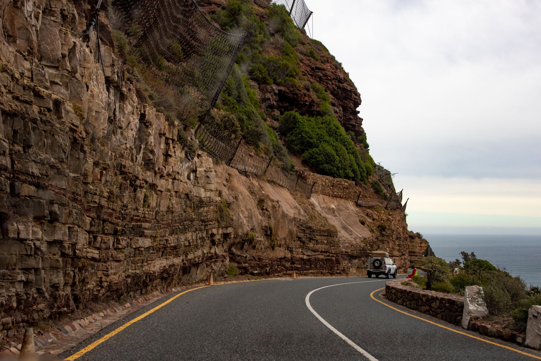
Chapman's Peak Drive
The cliff-hugging coast road between Hout Bay and Noordhoek, cut into the mountainside.
Trip Role
Ideal stay
Best for
Our take
This is a nine-kilometre masterclass in coastal engineering that demands your attention. It is a rare road that justifies the drive purely for the experience of the curves and the sheer drop to the Atlantic.
This is a nine-kilometre masterclass in coastal engineering that demands your attention. It is a rare road that justifies the drive purely for the experience of the curves and the sheer drop to the Atlantic.
- Trip Role
- Quick Stop
- Ideal Stay
- 45 to 60 minutes, including stops
- Best For
- coastal engineering, dramatic ocean views, a scenic peninsula link
- Skip If
- nervous drivers, those prone to motion sickness
- Go If
- You are driving the peninsula loop and want the most dramatic coastal route between Hout Bay and Noordhoek. It is essential for anyone who appreciates road design and high-contrast ocean views.
Why it's worth your time
Six kilometres of engineered cliff road with the Atlantic below. Toll road; closes in high wind. Sunrise is the time — the light hits the orange rock and the traffic hasn't arrived.
What we love
The way the road is carved directly into the cliff face creates a sense of exposure you do not get on standard highways. You are often driving beneath rock overhangs with the ocean hundreds of metres below, making the engineering feel like a physical part of the mountain itself.
What to know
This is a toll road that closes frequently for high winds, rain, or rockfall risk. Always check the official status online before you leave. If it is closed, you must use the inland route through Ou Kaapse Weg. Toll fees vary by vehicle type and payment methods, so have a card or cash ready at the plaza.
The full guide
Choosing your direction
Driving from Hout Bay towards Noordhoek is the preferred direction for most travellers. This keeps your vehicle on the seaward side of the road, making it significantly easier to pull into the designated viewpoints without crossing oncoming traffic. It also aligns with the standard flow for a full Cape Peninsula loop, allowing you to continue south toward Cape Point after you finish the drive. If you are travelling by tour bus, note that these vehicles are often restricted to this specific direction for safety reasons. While the drive is impressive in either direction, the western approach from Hout Bay provides a more logical progression for a day trip that includes the southern peninsula. If you are staying in Simon's Town, you may find it more efficient to visit Cape Point first and save the drive for your return leg if conditions allow.
The road and safety
The route consists of nine kilometres and 114 curves cut into the side of the mountain. The surface is generally well-maintained, but the road is narrow and hugs the cliff tightly. You will encounter sections where the rock overhangs the lane, and the drop-offs to the Atlantic are steep and unprotected by anything more than the road edge. While the road is safe for standard passenger vehicles, it demands constant focus. Do not attempt to take photographs while driving; use the designated bays provided for this purpose. These pull-ins are wide enough to exit your vehicle safely, but remain aware of your surroundings and keep food sealed to avoid attracting baboons. If you are driving a large vehicle or are uncomfortable with tight, winding roads, take the inland alternative through Ou Kaapse Weg instead.
Timing your visit
The road is highly sensitive to weather. It closes at short notice during high winds or after rain due to the risk of rockfall. Never build your entire day around this drive without a backup plan. Midday in summer is the busiest time, when the car parks fill up and the light becomes harsh and flat. Aim for early morning to catch the light hitting the orange rock face and to avoid the worst of the traffic. If you are visiting on a weekend, be aware that cyclists frequently use the road, which can slow traffic significantly on the narrow bends. Always check the live status on the official website before you depart, and check it again before you commit to the western leg of your journey if you are returning from the south.
Before you book
Questions Chapman's Peak Drive always raises
- Is the road safe for a standard rental car?
- Yes, the road is perfectly suitable for any standard passenger vehicle. It is a public toll road, not a 4x4 track. Just drive at a sensible speed, stay within your lane on the tight curves, and be prepared for the narrow width of the road.
- What happens if the road is closed when I arrive?
- If the road is closed, you must use the inland route. From Hout Bay, take the road over Constantia Nek or use Ou Kaapse Weg to reach the southern peninsula. These routes are reliable and do not suffer from the same weather-related closure risks as the cliff road.
- Do I need to book a ticket in advance?
- No, you do not book in advance. You pay the toll fee at the plaza when you arrive. The toll is payable by card or cash. Check the current tariff online before you go, as prices vary by vehicle category.
- Can I walk or cycle on the road?
- Cyclists use the road, but it is narrow and traffic can be fast, so exercise extreme caution. Walking along the road is not recommended due to the lack of pedestrian infrastructure and the risk of rockfall. Stick to the designated viewpoints to enjoy the scenery safely.